
 AI Governance
 Data Centers
 Drones
 Climate
 Privacy
 2026 Maine Senate
 Bob Dylan
Last Update: 09/15/2026 at 6:33 PM EST
Drones Gain Layered Navigation Without GPS
Coverage from sUAS News, Unmanned Systems Technology, and others
What's Going On
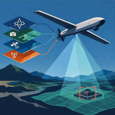
Embention unveiled the 190-gram Veronte KAI 2.
0 flight-control computer for loitering munitions, counter-UAS platforms, and one-way kinetic drones. Its layered navigation architecture combines inertial, optical, satellite, and cellular inputs, with cameras supporting visual odometry, terrain matching, target recognition, and terminal guidance when GNSS is unavailable or disrupted. The system is being positioned for defense production in Spain, the United Arab Emirates, and the United States, but the available reporting describes capabilities and intended uses rather than demonstrated field performance.
Additional Articles
⭐⭐⭐⭐⭐
Embention unveiled Veronte KAI 2.0 at the MSPO 2026 defense exposition in Poland, introducing layered navigation and autonomous guidance for GNSS-denied defense drones.
Embention introduced an upgraded Veronte KAI flight computer for loitering munitions and counter-UAS platforms at MSPO 2026 in Kielce, Poland.
⭐⭐⭐
Embention showcased the Veronte KAI 2.0 flight control computer at MSPO 2026 for autonomous one-way attack-drone missions in GPS-denied environments.